Zion Canyon packs very different hikes into a few miles: a flat paved riverside path, a short ridge walk, a lodge-side waterfall trail, a chain-assisted cliff route and a trek up a river. Pick by exposure, effort and access first; mileage comes second. This guide ranks the best hikes in Zion National Park by what each trail asks of you, and it uses National Park Service (NPS) figures wherever the park publishes them. For the bigger picture, see our Zion National Park travel guide.
Key points
- Easiest: Pa’rus Trail and Riverside Walk, both paved.
- Best short viewpoints: Canyon Overlook (1 mile round trip) and Watchman (3.3 miles round trip).
- Hardest: Angels Landing needs a permit for its chain section, and The Narrows means wading the Virgin River.
- Observation Point is no longer reachable from the canyon floor; the East Mesa route is the way in.
- Trail status changes. Check the NPS conditions page on the morning of your hike.
In this guide
The eight best hikes in Zion National Park at a glance
| Trail | Round trip | Elevation gain | NPS time estimate | Effort |
|---|---|---|---|---|
| Pa’rus Trail | about 3.5 mi | about 50–100 ft | About 2 hours (NPS guide) | Easy, paved |
| Riverside Walk | about 2 mi | Not listed by NPS | 1–2 hours | Easy, paved |
| Canyon Overlook | 1 mi | about 150 ft | 1–2 hours | Moderate, drop-offs |
| Watchman | 3.3 mi | about 370–480 ft | About 2 hours | Moderate |
| Emerald Pools | about 1.2 mi to the Lower pool | Rises with each pool | 1–2 hours per pool trail | Easy to moderate |
| Angels Landing | 5.4 mi | about 1,488 ft | About 4 hours | Strenuous, permit for chains |
| The Narrows (bottom-up) | up to 9.4 mi | about 334 ft | 1–8 hours | Strenuous, wading |
| Observation Point (East Mesa) | 6.8 mi | about 300 ft | About 3 hours | Moderate to strenuous |
Distances, elevation gain and times are NPS figures where the park publishes them, and they differ slightly between NPS pages. Treat them as planning estimates, not measurements. Your pace, stops and the day’s conditions change them.
How to choose a Zion hike
Start with three questions. Are you comfortable on narrow trails with steep drop-offs? Are you willing to walk in cold, moving water? And how do you get to the trailhead: by shuttle, by car, or by a dirt road?
Those answers narrow the best hikes in Zion National Park faster than distance does. A one-mile trail with drop-offs can feel harder than a longer, flat path, and a short river walk can be more tiring than a long dry one. Heat matters too: summer highs regularly pass 100°F (38°C), according to NPS.
- Short on time or first visit: Riverside Walk, or Canyon Overlook if you can find parking.
- Families, strollers or low effort: Pa’rus Trail and Riverside Walk, both paved.
- Best view for the effort: Canyon Overlook (short, with drop-offs) or Watchman (longer, no chains).
- Waterfalls and pools: Lower Emerald Pool, then the middle and upper pools if you want more climbing.
- Afraid of heights: skip Angels Landing beyond Scout Lookout, and take care at Canyon Overlook’s fenced edge.
- A full-day challenge: The Narrows when conditions allow, Angels Landing with a permit, or Observation Point via East Mesa if your vehicle can handle the road.
Easy hikes for a relaxed day
Pa’rus Trail
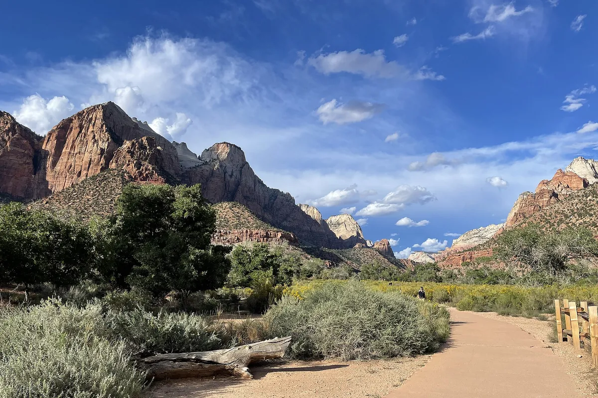
Pa’rus is a paved path beside the Virgin River, running from the Zion Canyon Visitor Center toward Canyon Junction. NPS trail data lists the main stretch at 1.6 miles one way with five bridges, and its printed visitor guides give the trail as about 3.5 miles round trip with only around 50 feet of elevation change. NPS also groups it with its easy trails, which gain no more than 100 feet. Plan on roughly 3.5 miles out and back from the Visitor Center.
It is the gentlest long walk in the canyon, and the one to pick when the weather is hot or the group includes small children. NPS notes occasional tripping hazards on the pavement, so it is smooth but not perfectly uniform.
Riverside Walk
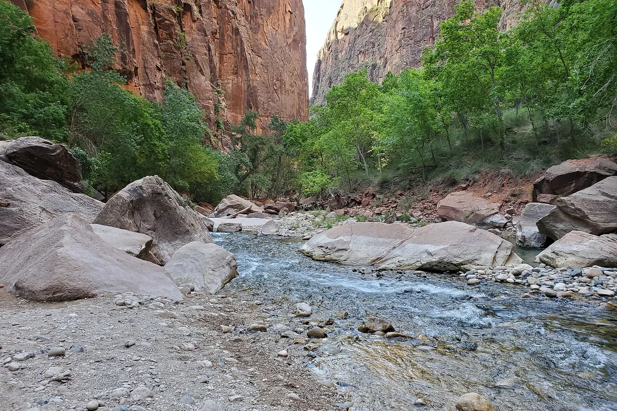
Riverside Walk starts at the Temple of Sinawava, the last shuttle stop (stop 9). NPS describes about 1 mile of easy paved trail to the end of the pavement, where the river hike into The Narrows begins. Walk to the end and back for roughly 2 miles round trip, with high canyon walls and hanging vegetation along the way.
This is the approach to The Narrows, not the river hike itself. You can turn around at the end of the pavement without getting wet.
Short climbs with big views
Canyon Overlook Trail
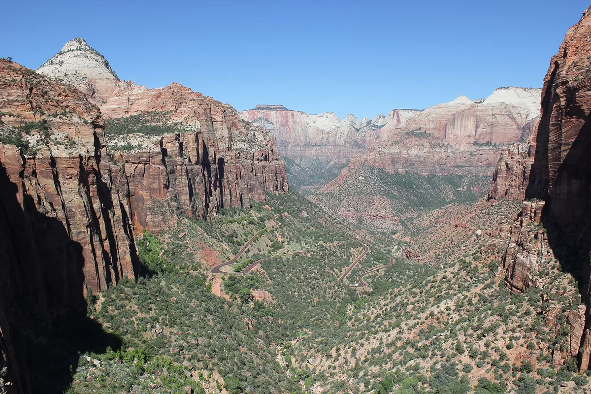
Canyon Overlook is about 1 mile round trip with around 150 feet of elevation gain (NPS lists about 154 feet) and an estimated 1 to 2 hours. The trailhead sits just east of the Zion–Mount Carmel Tunnel, outside the shuttle corridor. NPS says parking there is extremely limited and to be prepared to try multiple times.
NPS notes staircases, uneven rock steps and a stretch beneath overhanging rock, and parts of the path run beside steep drop-offs. The trail ends at a fenced cliff edge above a slot canyon, with a view down into the main canyon for relatively little effort.
Watchman Trail
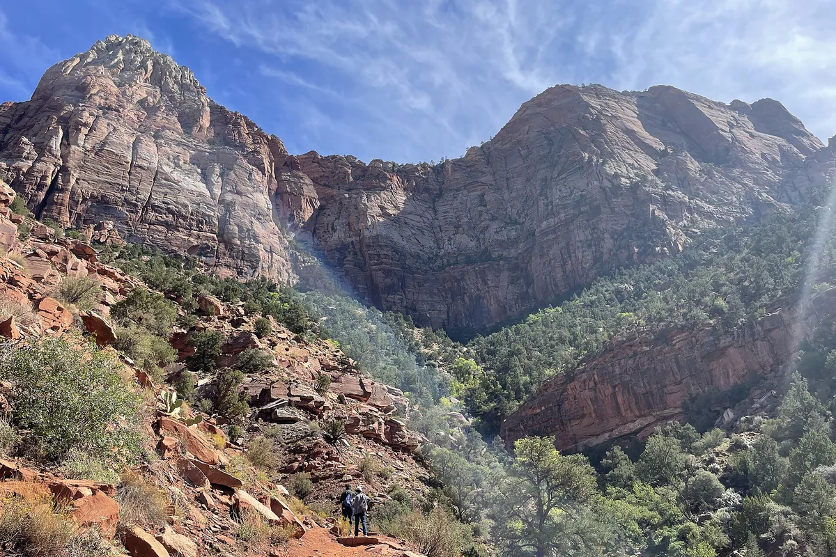
Watchman is about 3.3 miles round trip, and NPS estimates around 2 hours. It climbs by switchbacks from near the Visitor Center to a viewpoint over the canyon mouth and Springdale. NPS figures for the climb range from about 370 to about 480 feet depending on the page and the segment measured.
The trail is sunny and exposed for much of the way up, which makes early morning or late afternoon more pleasant in warm months.
The Emerald Pools trails
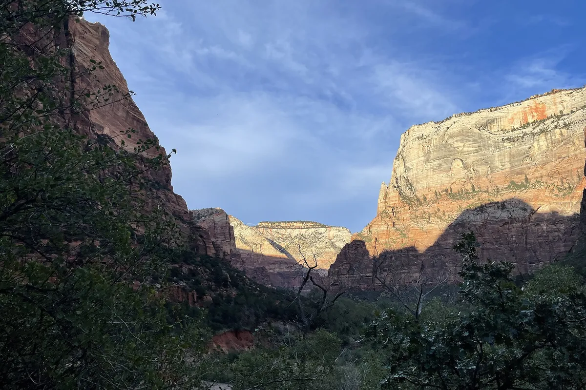
The Emerald Pools trails leave from Zion Lodge (shuttle stop 5) and climb in stages, so you can stop at whichever pool matches your energy.
- Lower Emerald Pool: about 0.6 mile one way, mostly concrete. The easiest of the three.
- Middle Emerald Pool: about 0.9 mile one way from the Lodge, steeper, with staircases.
- Upper Emerald Pool: about 0.3 mile one way beyond that, with tall steps and stretches of soft sand.
Water flow varies by season, so waterfalls can be strong after rain or snowmelt and thin or dry in other months. Check NPS trail alerts first, because individual sections can close for repairs or rockfall.
Strenuous hikes
Angels Landing
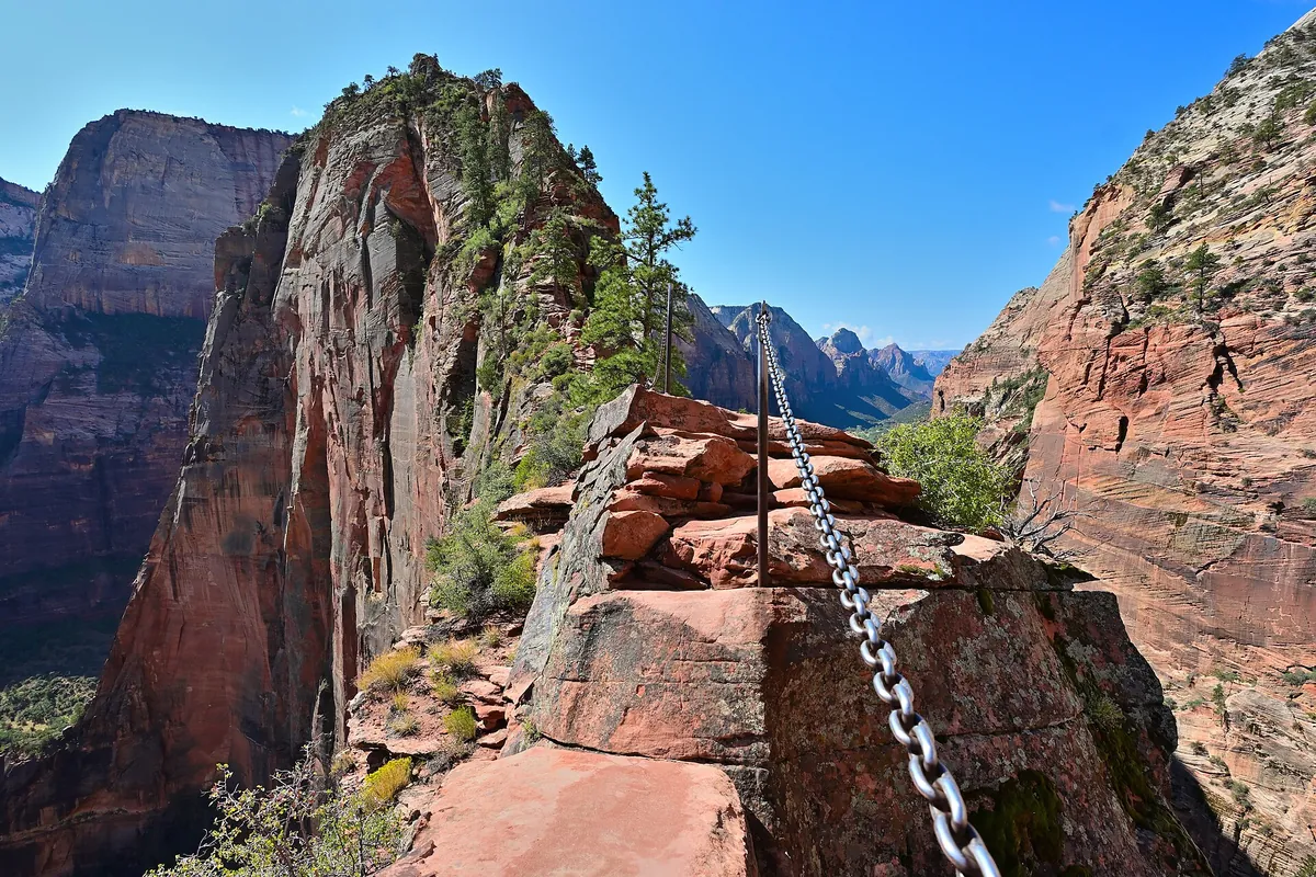
Angels Landing is 5.4 miles round trip with about 1,488 feet of gain, and NPS says most hikers need around 4 hours. Scout Lookout, where the hardest part begins, is about 2.25 miles from the Grotto shuttle stop (stop 6) with roughly 1,000 feet of climbing, so the first section is already a serious uphill hike.
From Scout Lookout the route continues for about half a mile along a narrow ridge, with a single chain for support and steep drop-offs on both sides. NPS states that the majority of deadly accidents on the trail since 1930 have occurred on this section, and that most chain-section accidents happen in wet conditions.
Permits. Everyone hiking the chain section needs a permit. You do not need one to reach Scout Lookout or to hike the West Rim Trail. Permits are issued by lottery: a seasonal lottery months ahead and a day-before lottery. At the time of writing, NPS lists a $6 non-refundable application fee plus $3 per person for awarded permits, and the confirmation email serves as the permit. Dates and fees can change, so use the official NPS permit page for current rules.
NPS advises against attempting the climb in storms, on wet or icy rock, if you may run out of daylight, or if you are afraid of heights. Turning around at Scout Lookout is a sensible decision, not a failure.
The Narrows (bottom-up)
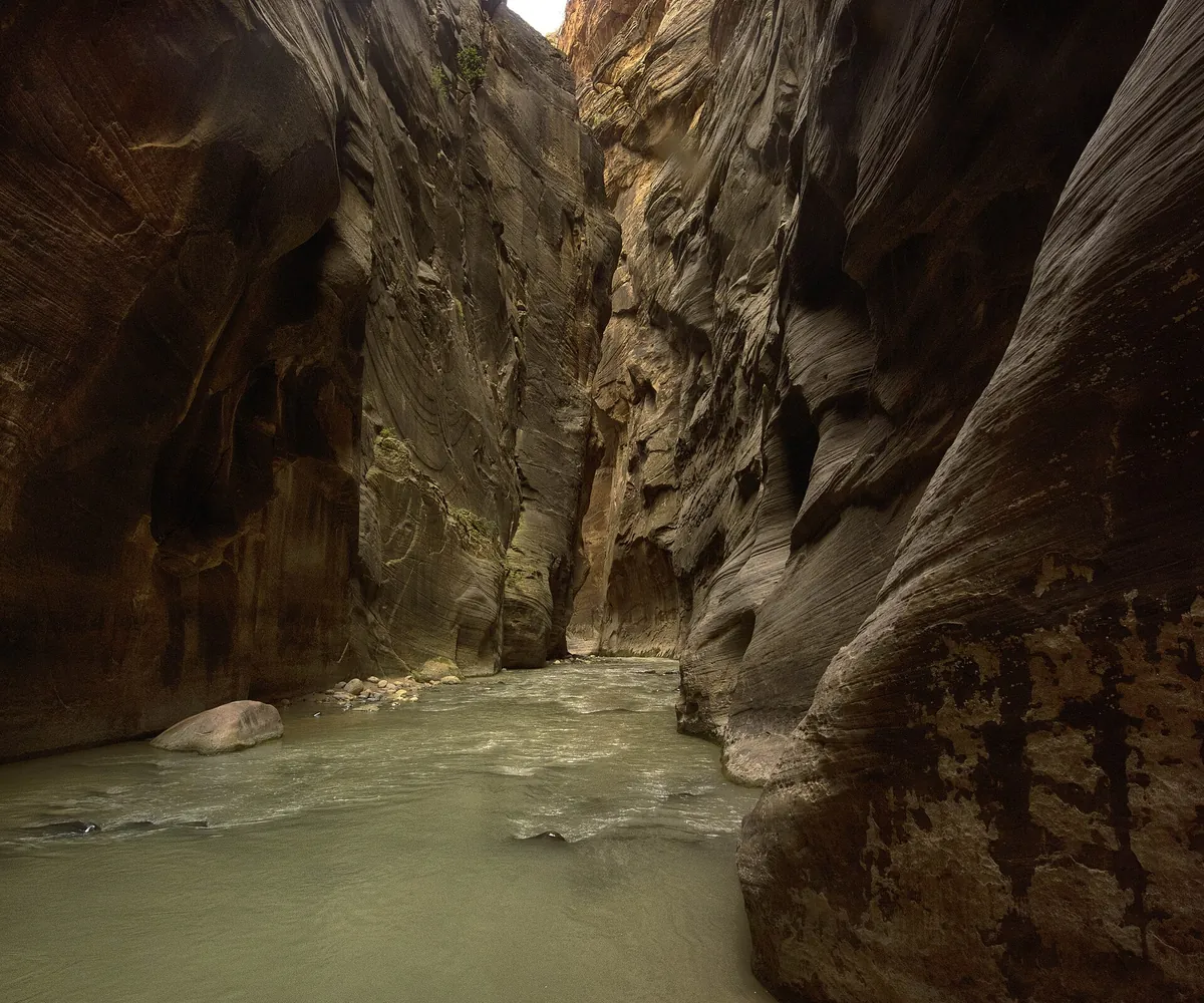
The Narrows is a hike in the Virgin River itself, between tall canyon walls. The bottom-up day hike starts from the end of Riverside Walk and has no fixed destination: NPS describes it as up to 4.7 miles one way to Big Spring, or 9.4 miles out and back, with about 334 feet of elevation change and an estimated 1 to 8 hours depending on how far you go.
NPS says no permit is required for the bottom-up day hike up to Big Spring. The roughly 16-mile top-down route is a different trip and requires a wilderness permit.
Expect to be in cold water for most of the day. NPS recommends closed-toe shoes or boots rather than sandals or Crocs, and a hiking stick or pole. Many visitors bring dry suits or waders in cooler months. The park does not sell or rent gear.
The Narrows closes when river flow exceeds 150 cubic feet per second or when the National Weather Service issues a flash flood warning. NPS has also warned that toxic cyanobacteria may be present in the Virgin River, so avoid submerging your head and do not drink the water. Check the NPS current conditions page before you commit.
Observation Point
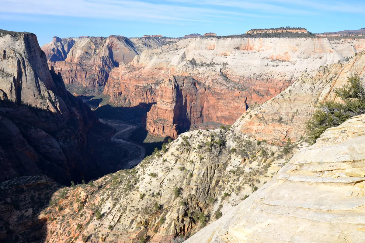
Observation Point is the high viewpoint above the main canyon, and the way to reach it has changed. NPS reports that the East Rim Trail from Weeping Rock is closed after a major rockfall, and that Observation Point cannot currently be reached from Zion Canyon.
The route that works is Observation Point via the East Mesa Trail, which starts on the east side of the park. NPS lists it at about 6.8 miles round trip with roughly 300 feet of elevation gain and an estimated 3 hours. The trail gains little elevation for a viewpoint this high, because the trailhead already sits well up on the east mesa.
The catch is the road. NPS describes the East Mesa Trailhead as reachable by high-clearance or four-wheel-drive dirt roads off North Fork Road, and the shuttle does not go there. NPS says these roads can be very muddy and may be impassable in winter, spring and after rainstorms, so check road conditions before you leave.
Shuttles, permits and access
During shuttle season, you cannot drive your own vehicle on Zion Canyon Scenic Drive. The free Zion Canyon Line shuttle covers the canyon, and NPS says it needs no ticket or reservation. Shuttle service runs from early spring to late fall; when it stops, the scenic drive may open to private vehicles. Exact dates change, so check the shuttle page.
| Trail | Where you start | What to check |
|---|---|---|
| Pa’rus and Watchman | Zion Canyon Visitor Center area (stop 1) | Shuttle status in season |
| Emerald Pools | Zion Lodge (stop 5) | Trail alerts and closures |
| Angels Landing | The Grotto (stop 6) | Permit for the chain section |
| Riverside Walk and The Narrows | Temple of Sinawava (stop 9) | River flow and flash flood warnings |
| Canyon Overlook | Parking area just east of the Zion–Mount Carmel Tunnel | Limited parking |
| Observation Point (East Mesa) | East Mesa Trailhead, off North Fork Road | Dirt-road conditions; no shuttle |
Safety checks before you go
Check the NPS conditions page for closures, alerts and river status. As of NPS’s September 2026 update, Hidden Canyon was closed and the East Rim Trail was partly closed after rockfall, so do not rely on older trail lists.
- Water and heat. NPS suggests about 1 gallon (4 liters) of water per person per day for Angels Landing, where there is no drinkable water beyond the Grotto. Summer heat in the canyon is intense.
- Flash floods. Floods can occur even when the sky above you is clear, because storms upstream feed the river. Monsoon season in mid-to-late summer carries the highest risk.
- Footing. Wet rock is the main hazard on exposed routes. NPS specifically warns against Angels Landing in rain, thunderstorms or icy conditions.
- Daylight. Plan to finish before dark and carry a light for longer hikes.
Planning your day
One strenuous hike is enough for most people. Angels Landing and The Narrows each take a large part of a day, and neither suits a rushed schedule.
- A few hours: Choose one easy trail, such as Pa’rus or Riverside Walk.
- A half day: Combine Watchman with an easy walk, or do the Lower Emerald Pool and Riverside Walk.
- A full day: Choose one of Angels Landing (to Scout Lookout or the summit), The Narrows or Observation Point via East Mesa.
Planning around the seasons? Ice, shuttle changes and closures affect which trails are practical from December to February, so read our guide to visiting Zion in winter before you finalize a plan.
Common questions
Do I need a permit for Angels Landing? Yes for the chain section beyond Scout Lookout. You can hike to Scout Lookout without one.
Do I need a permit for The Narrows? Not for the bottom-up day hike up to Big Spring, according to NPS. The top-down hike needs a wilderness permit.
Which Zion hike is best for beginners? Pa’rus Trail and Riverside Walk are paved and easy. Canyon Overlook is short but has drop-offs.
Can I hike Observation Point from Zion Canyon? Not at present. NPS reports the route from Weeping Rock is closed after a rockfall; use the East Mesa route instead.