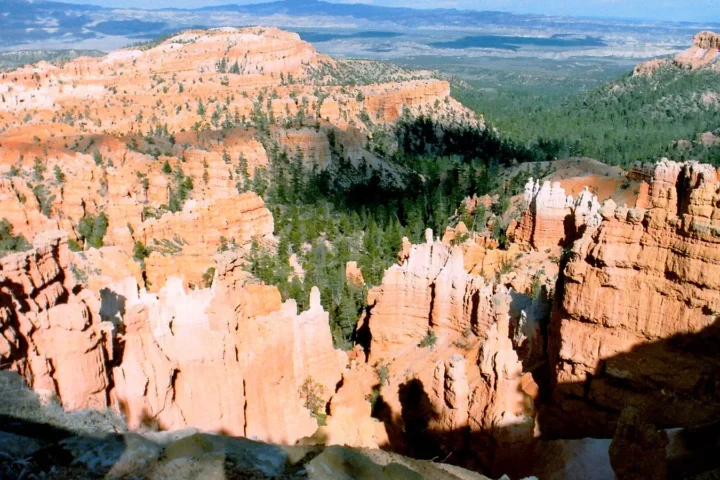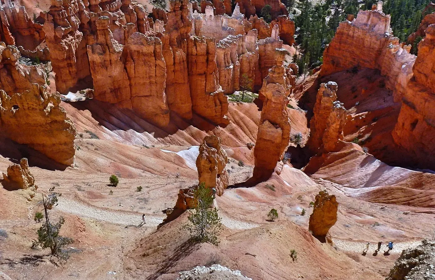
The best Bryce Canyon hikes are the ones that go down into the amphitheater among the hoodoos, and the classic first choice is the Queen’s Garden/Navajo Combination Loop: about 2.9 miles, 2 to 3 hours, and roughly 625 feet of elevation change, according to the National Park Service (NPS). Shorter rim walks need almost no effort, and longer loops such as Peekaboo and Fairyland turn the park into a full-day outing. This guide ranks the trails by effort, time and scenery, using the NPS day-hike table, and flags where NPS pages disagree.
Key points
- First hike: Queen’s Garden/Navajo Combination, about 2.9 miles and 2 to 3 hours, done clockwise.
- Easiest: The Rim Trail between Sunrise and Sunset Points, about 1 mile round trip, paved.
- Biggest day: Figure-8 (6.4 miles) or Fairyland Loop (8.0 miles).
- Every canyon trail climbs back out. Plan for altitude: the park sits at roughly 8,000 to 9,115 feet.
- Winter: NPS recommends traction devices, and the Navajo Loop is not a loop in winter.
Table of Contents
Bryce Canyon hikes at a glance
| Trail | Distance | Time | Elevation change | Starts at |
|---|---|---|---|---|
| Sunset to Sunrise Point (Rim Trail) | 1.0 mi round trip | 1 hr | 40 ft | Sunset Point |
| Mossy Cave | 0.8 mi | 1 hr | 150 ft | North end of park, 4 mi east on Hwy 12 |
| Bristlecone Loop | 1.0 mi | 1 hr | 200 ft | Rainbow or Yovimpa Point |
| Queen’s Garden | 1.8 mi | 1–2 hrs | 450 ft | Sunrise Point |
| Navajo Loop | 1.3 mi | 1–2 hrs | 515 ft | Sunset Point |
| Queen’s/Navajo Combination | 2.9 mi | 2–3 hrs | 625 ft | Sunset or Sunrise Point |
| Tower Bridge | 3.0 mi | 2–3 hrs | 760 ft | North of Sunrise Point |
| Swamp Canyon Loop | 4.0 mi | 3–4 hrs | 800 ft | Swamp Canyon |
| Hat Shop | 4.0 mi | 3–4 hrs | 1,380 ft | Bryce Point |
| Peekaboo Loop | 5.5 mi | 3–4 hrs | 1,560 ft | Bryce Point |
| Figure-8 Combination | 6.4 mi | 4–5 hrs | 1,575 ft | Sunrise or Sunset Point |
| Fairyland Loop | 8.0 mi | 4–5 hrs | 1,900 ft | Fairyland Point or north of Sunrise Point |
These figures come from the NPS day hikes page, which was last updated in October 2024. NPS pages are not fully consistent: an older NPS page (September 2021) lists Swamp Canyon as 4.3 miles. Treat all numbers as planning estimates and check current conditions before you go.
How to choose a Bryce Canyon hike
Bryce is unusual because the views from the rim and the experience below it are different things. Three questions decide most choices:
- How much climbing do you want? Every trail into the canyon ends with an uphill return. NPS says to turn back before you are tired, because all trails return uphill.
- How much time do you have? A rim walk takes an hour, the classic combination takes two to three hours, and the long loops take half a day or more.
- What scenery do you want? Hoodoo-filled amphitheater trails are the park’s signature; Bristlecone Loop offers forest and long views from the south end of the park; Mossy Cave offers water and a different corner of the area.
Easy hikes and rim walks
Rim Trail: Sunset to Sunrise Point
This is the easiest way to see the amphitheater. NPS lists the Sunset to Sunrise stretch at 1.0 mile round trip with about 40 feet of elevation change, and it is paved between the two points. The full Rim Trail runs up to 11 miles round trip by NPS’s listing and is not a loop, so you can walk as little or as much as you like and shuttle back.
Bristlecone Loop
A 1.0-mile loop at the south end of the park, with about 200 feet of elevation change, through spruce-fir forest to cliffs with bristlecone pines. NPS puts the high point of the park at 9,115 feet, so this is also a good place to feel how thin the air is.
Mossy Cave
Mossy Cave is a short 0.8-mile walk with about 150 feet of elevation change, at the north end of the park along Highway 12. NPS’s easy-hikes page says the waterfall flows from May through October, and its day-hikes page says the trail has become extremely crowded and advises against visiting between 10 a.m. and 6 p.m. Parking outside the lot risks a ticket or tow.
Canyon hikes: Queen’s Garden, Navajo Loop and the classic combination
Queen’s Garden
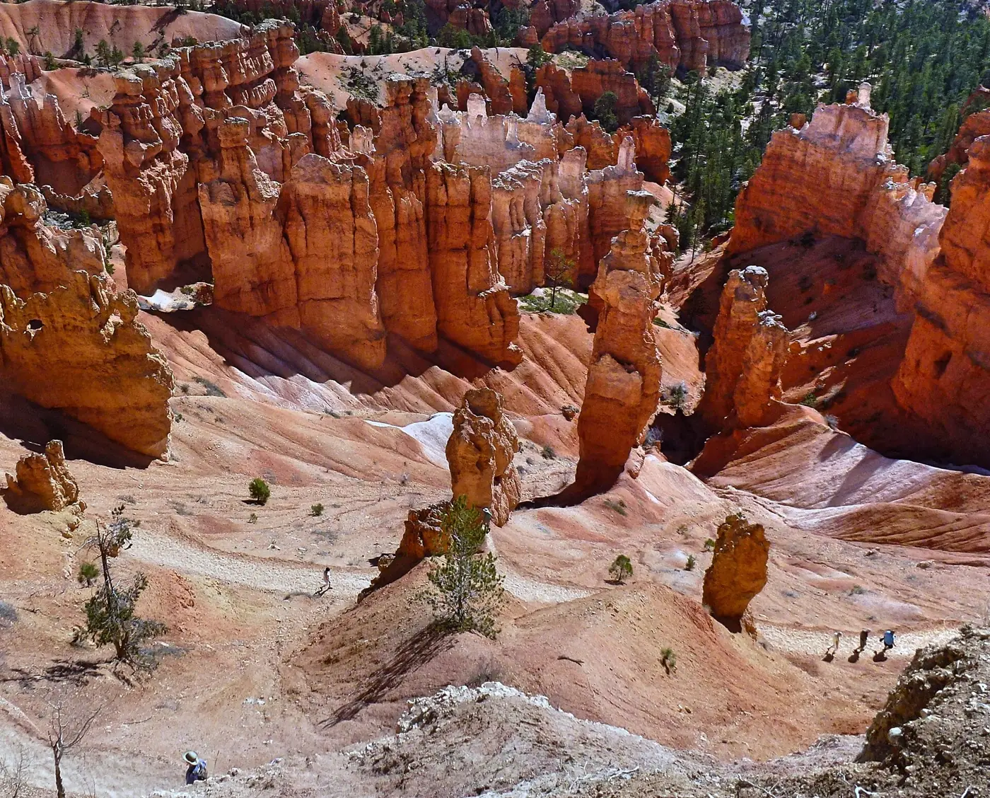
NPS calls Queen’s Garden the least difficult of the trails that descend into the canyon. It starts at Sunrise Point, runs 1.8 miles round trip and gains back about 450 feet according to the NPS table. A short spur leads to a formation that can resemble Queen Victoria.
Navajo Loop
The Navajo Loop starts at Sunset Point, covers 1.3 miles with about 515 feet of elevation change, and descends through a slot canyon on steep switchbacks. NPS says most injuries happen on the steeper Navajo side. It also says the Two Bridges side stays open year-round while the Wall Street side closes when wet weather and freezing nights coincide, so in winter the Navajo Loop is not a loop.
Queen’s Garden/Navajo Combination Loop
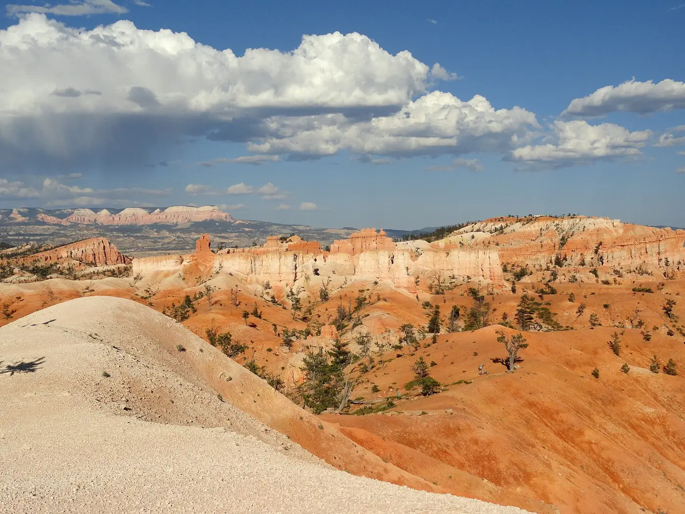
Combine them for 2.9 miles, 2 to 3 hours and about 625 feet of elevation change. NPS recommends going clockwise: descend Queen’s Garden and climb the Navajo side. It works from either Sunrise or Sunset Point, and it is the single best answer to the question of what to hike in Bryce if you only have a morning.
Tower Bridge and Swamp Canyon
Tower Bridge is 3.0 miles with about 760 feet of elevation change, part of the Fairyland Loop, with a shaded quarter-mile spur to the bridge. Swamp Canyon is a quieter 4.0-mile loop (4.3 on one NPS page) with about 800 feet of elevation change.
Longer loops and full-day hikes
- Peekaboo Loop: 5.5 miles, 3 to 4 hours, about 1,560 feet of elevation change, from Bryce Point. NPS requires clockwise travel.
- Navajo/Peekaboo Combination: 4.9 miles, 3 to 4 hours, about 1,475 feet, from Sunset Point.
- Figure-8 Combination: 6.4 miles, 4 to 5 hours, about 1,575 feet. It joins Queen’s Garden, Peekaboo and Navajo.
- Fairyland Loop: 8.0 miles, 4 to 5 hours, about 1,900 feet. NPS describes it as a picturesque, less crowded trail. Fairyland Point is not a stop on the Bryce shuttle.
- Hat Shop: 4.0 miles out and back, 3 to 4 hours, about 1,380 feet, from Bryce Point on the Under-the-Rim Trail, which NPS’s conditions page flags for deteriorated sections.
- Bryce Amphitheater Traverse: 4.7 miles, 3 to 4 hours, about 1,145 feet, from Bryce Point to Sunrise Point; return by shuttle or the 3.2-mile Rim Trail.
The Under-the-Rim Trail is a 22.9-mile backcountry route from Rainbow Point to Bryce Point, typically a one- to two-night trip that requires a backcountry permit for overnight stays. NPS’s conditions page warns of deteriorated sections and says hikers use the trail at their own risk and need strong wayfinding skills. It falls outside this guide.
Trailheads, parking and the shuttle
The main amphitheater trailheads are Sunrise Point, Sunset Point and Bryce Point, with Fairyland Point at the north end and Rainbow and Yovimpa Points at the south end of the park road. The free shuttle stops at Bryce Point (stop 8), Inspiration Point (stop 9), Sunset Point (stop 11) and Sunrise Point (stop 13, a 0.2-mile walk from the stop). NPS’s stop list does not include Fairyland Point, Mossy Cave or the southern viewpoints, so those need a car. NPS lists the 2026 shuttle season as April 3 to October 18 and calls it highly recommended but not required, because of congestion and limited parking at viewpoints; check the NPS shuttle page for current dates. Entry costs $35 per vehicle on the NPS fees page (updated May 2026). Our Zion to Bryce Canyon guide covers the drive in.
Seasons, snow and closures
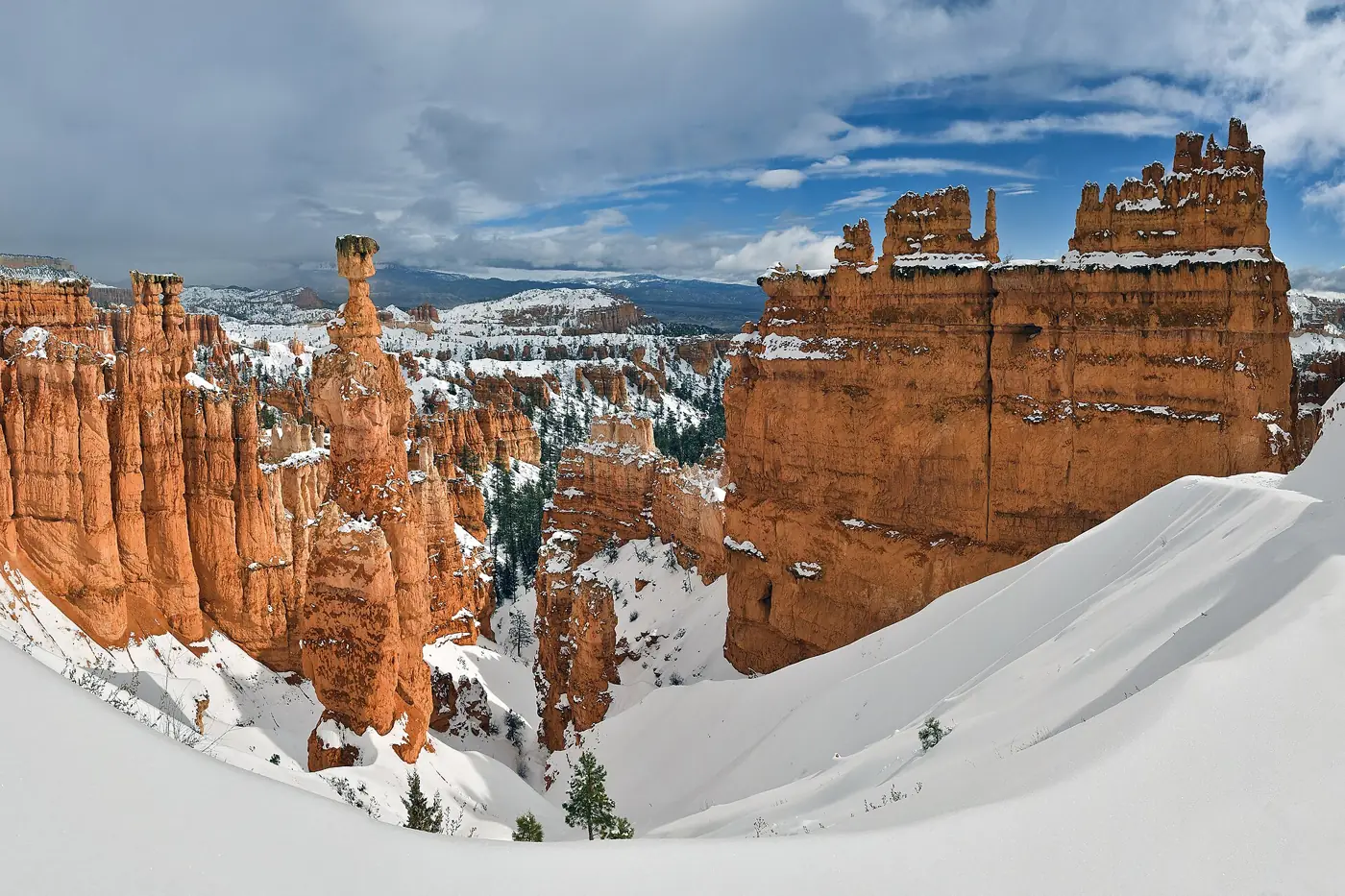
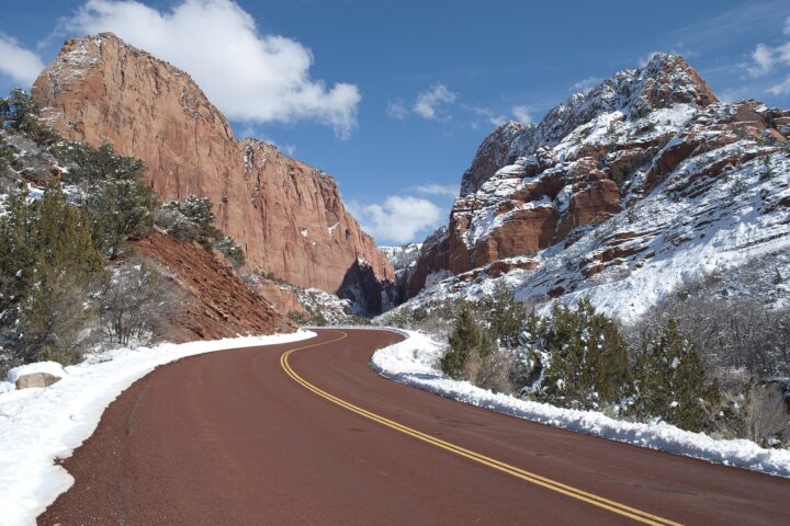
Bryce is open year-round, and NPS posts trail conditions at the visitor center. The points in this section are NPS guidance on conditions; the pairings elsewhere in this guide are our own suggestions. NPS strongly recommends traction devices on all park trails in winter. The Navajo Loop is not a loop in winter, so Queen’s/Navajo should use the Two Bridges side. The 1.5-mile Rim Trail section from Bryce Point to Inspiration Point is regularly closed in winter, and the Figure-8 may be inaccessible in mid-winter because of snow depths of 2 to 15 feet. Lightning can happen year-round and is most frequent in summer storms.
Family-friendly hikes
Our grading, based on NPS length and grade: the paved Sunset to Sunrise Point stretch of the Rim Trail is the easiest option, and NPS describes that section as accessible. Bristlecone Loop (1.0 mile), Mossy Cave (0.8 mile) and Queen’s Garden (1.8 miles, with a climb back out) are the next steps up. Cliff edges are close on rim trails, so keep children near you. The longer loops are better left for older hikers.
Short hike or full day?
- About an hour: Sunset to Sunrise Point on the Rim Trail (NPS lists 1 hour).
- Two to three hours: Queen’s Garden alone (NPS lists 1 to 2 hours) or the Queen’s/Navajo Combination Loop (2 to 3 hours). Doing the rim walk and Queen’s Garden together takes two to three hours, not one to two.
- Half a day to most of a day: Peekaboo, Figure-8 or Fairyland (3 to 5 hours of walking by NPS’s listing, plus time for rests, photos and the climb out). Fairyland is the quietest.
These pairings are our own suggestion, built from the NPS times above; they are not NPS recommendations.
Safety and altitude
- Altitude: The visitor center sits at 7,894 feet and park elevations reach 9,115 feet, where NPS says you get about 70% of the oxygen you may be used to.
- Footwear: NPS recommends hiking boots with ankle support and lugged soles, not sport sandals or trainers, and says unsuitable footwear is the number one cause of rescues and hospital visits.
- Water: NPS suggests about a quart (1 liter) every one to two hours.
- Lightning: If you hear thunder, lightning is within 10 miles. Seek a building or vehicle.
- The return climb: Every canyon trail climbs back out, so turn around before you are tired.
Plan your Bryce Canyon trip
- Zion to Bryce Canyon: route, stops and timing between the two parks.
- Things to do in Kanab: a base about 1 hour 20 minutes from Bryce by regional tourism estimates.
- Zion National Park travel guide: if Zion is on the same trip.
Guides to Bryce Canyon’s other attractions, airports and lodging are planned and are not yet published.
Common questions
What is the best hike in Bryce Canyon? For most first-time visitors it is the Queen’s Garden/Navajo Combination Loop, about 2.9 miles and 2 to 3 hours.
How long are the hikes? From about an hour for rim walks to four to five hours for the Figure-8 or Fairyland Loop.
Are Bryce Canyon hikes hard? The canyon trails are short but steep, and every one climbs back to the rim. Altitude makes them feel harder.
Can you hike Bryce Canyon in winter? Yes, with traction devices. The Navajo Loop is not a loop in winter, and the Figure-8 may be inaccessible in mid-winter.
Sources